The other day I posted a video showing GOES space imagery of the severe storms that blasted across the United States on April 27. NASA has other satellites that observe the Earth as well, including Aqua, which captured the image below of the aftermath of the storms. The picture is centered on Tuscaloosa, Alabama, and you can clearly see the tracks in the ground left by the killer tornadoes that swept through the state.
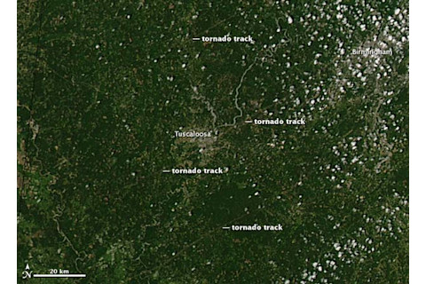
The videos people took of the tornadoes are absolutely terrifying. The Red Cross was in the area immediately after the storms went through; if you have a mind to, they are as always accepting donations. Images like this help meteorologists track down and understand the conditions for such storms to form. Obviously, the better we understand those conditions the more prepared we can be. And the farther in advance we can predict these storms -- even by minutes -- the more lives we can save. Image credit: Jeff Schmaltz, MODIS Rapid Response Team, NASA GSFC.


