The first day of June 1988 was sunny, hot and mostly calm — perfect weather for the three young researchers from Canada’s University of Windsor hunting for critters crawling across the bottom of Lake St. Clair. A whining outboard pushed the 16-foot-long runabout carrying Sonya Santavy, a freshly graduated biologist, toward the middle of the lake that straddles the U.S. and Canadian border.
Myriah Richerson/USGS
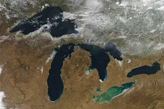
On a map, Lake St. Clair looks like a 24-mile-wide aneurysm in the river system east of Detroit that connects Lake Huron to Lake Erie, and that is essentially what it is. Water rushes quickly through Lake St. Clair because it is as shallow as a swimming pool in most places, except for a roughly 30-foot-deep navigation channel down its middle. The U.S. Army Corps of Engineers carved that pathway more than half a century ago as part of the St. Lawrence Seaway project to ...


